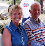
One of the things that we decided to do while in Harney County, was to have Ansel show us where Terry and Martina’s ashes were scattered. Bob was glad for the opportunity to pay his respects to the final resting place of their earthly bodies.
Ansel and Martina used to own some property up the Silvies River NW of Five Mile Dam, above the Baker place. It was purchased from the Ilda May Hayes family and was known during their ownership as the Cottonwood field and it was bordered to the south and west by their BLM permit.
Ansel loves to tell the story of when Terry was 12 years old and he gave him a 257 Roberts deer rifle. It was Terry’s official first year of hunting. There is a certain point of rocks on the south fence of the Cottonwood field about ½ mile from the SW corner of the property. It’s not very far off the Skull Creek road. A draw comes from south and the Silvies drainage runs east to west in front of it. Ansel said that he left Terry there on point with his new rifle and with all the formal instructions a father would give a son. A bit later after hearing several rounds fired from the area he had left Terry… Ansel hurried back to find Terry with his first buck deer and his second buck deer and his first bob cat.
Ansel said that this serene vista was Terry’s favorite spot on the whole ranch and he had come back to it often in his adult-life. Combined with it’s beauty and the special memories of Terry’s first deer hunt, it was a natural choice to scatter Terry and Martina’s ashes.
So we set out to find the spot. The BLM has done a significant juniper cutting project on the south side of the fence and that made it a little difficult to get to the fence line, but we did. Once we made it to the fence line at the top of the saddle, that separates the BLM and private, it was fairly easy to find to find the rocky point. It was just as Ansel described. (Ansel had waited at the PU) We took several photos and Bob’s GPS Navigator with us to record the coordinates. Then we boaged around a bit looking for arrowheads. That was unsuccessful, but the wild flowers that were out were breath taking.

Ansel points the way

The Rocky Point (from below)

Looking north from the point, the Silvies River is in the canyon running east and west.


No comments:
Post a Comment